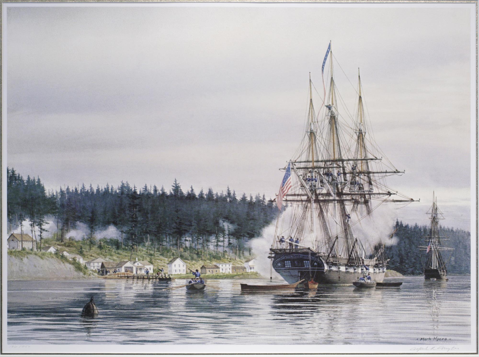
Imagine a small settlement on the shore of a bay. There are only a few houses, a dark forest stands like a wall all around, and nearby is a large camp of people who believe the settlers have taken their land. It seems the settlement has no chance. But on January 26, 1856, Seattle held out. Historians still debate the details, but one thing is clear: courage and weapons were not the only things that helped. The settlement’s layout helped too: where it was built, which trees were cut down, and what its defenses were made of.
Why Seattle was built here
The first settlers landed at Alki Point in 1851. It was a difficult place to live: the exposed shore was battered by wind, and the water near the coast was too shallow for large ships. So in 1852, they moved across the bay to Elliott Bay. It was like choosing a spot closer to the water for a sandcastle: convenient, and easy to fill the moat.
The main advantage of this location was invisible: deep water right along the shore. Later, this allowed a large warship to come almost up to the settlement’s streets. The settlers chose the bay for trade and a port, and as it turned out, they had also chosen a place where a ship could come to their aid.
The sawmill that cleared the forest
In 1853, entrepreneur Henry Yesler built a steam-powered sawmill on the shore, the first on Puget Sound. Logs were hauled down the hill along a special road called Skid Road. The name later came to mean poor urban neighborhoods, but it started with logs.
To keep the sawmill running, the forest around it was cut down. This created an open clearing between the shore and the wall of trees. Yesler was probably thinking about lumber and money, not defense. But when danger came, the clearing turned out to be just what was needed: no one could approach unseen from the forest. It was like being on a level floor in a game rather than among dense bushes: you can be seen from far away.
One day in January
By the winter of 1855, war had broken out. Residents built blockhouses—sturdy buildings made of thick logs, with narrow loopholes. Women and children were moved to safe places for a time. The sloop Decatur was anchored in the bay nearby. Its captain was Guert Gansevoort, a cousin of writer Herman Melville, author of Moby-Dick.
The attack began on January 26 and continued throughout the day. The attackers came out of the forest to the edge of the clearing. They were easy to see from the blockhouses and the ship. The ship’s cannons fired at the forest’s edge. The noise and explosions kept the attackers at a distance, and by evening they had retreated. Two settlers, Milton Holgate and Christian White, were killed in the settlement. Historians give different estimates of the number of attackers, so it is best not to repeat a precise figure.
It was like a chess game in which the powerful pieces are well positioned: the bay, the clearing, the blockhouses and the ship worked together. Each decision on its own was ordinary, but together they proved powerful.
And why did it all begin?
It is important not to forget the other side of the story. These lands had belonged to Indigenous peoples for centuries before the settlers arrived. Under the 1854 Treaty of Medicine Creek, they were assigned very small tracts, often without access to water or fishing, even though fish were the foundation of their way of life. Many felt they had been cheated. Leschi, a Nisqually leader, headed the resistance. He was later arrested and hanged in 1858. Many years later, in 2004, a special historical court in Washington State ruled that his conviction had been unjust.
Chief Seattle (known locally as Si’ahl), after whom the city was named, was friends with the settlers and tried to preserve peace. It must have been very difficult for him to see people he considered friends and members of his own people on opposite sides.
What this story teaches us
I think the most interesting thing here is this: when we look at an old map of a city, all we see are lines—streets, a shoreline, a hill. But every line was drawn by someone, for a reason. The street now called Yesler Way began as a trail for hauling logs. The deep bay was first just a convenient place to moor boats. The clearing was made by a saw, not for a war. Those ordinary decisions later played an enormous role.
And this is also a reminder that every victory has a cost and another side to the story. If you walk around modern Seattle, look at the hill, the water and the streets along the shore. They remember that day. Try to imagine what it looked like when there was a clearing and a wall of forest, and think not only of those who lived in the blockhouses, but also of those who stood at the forest’s edge.