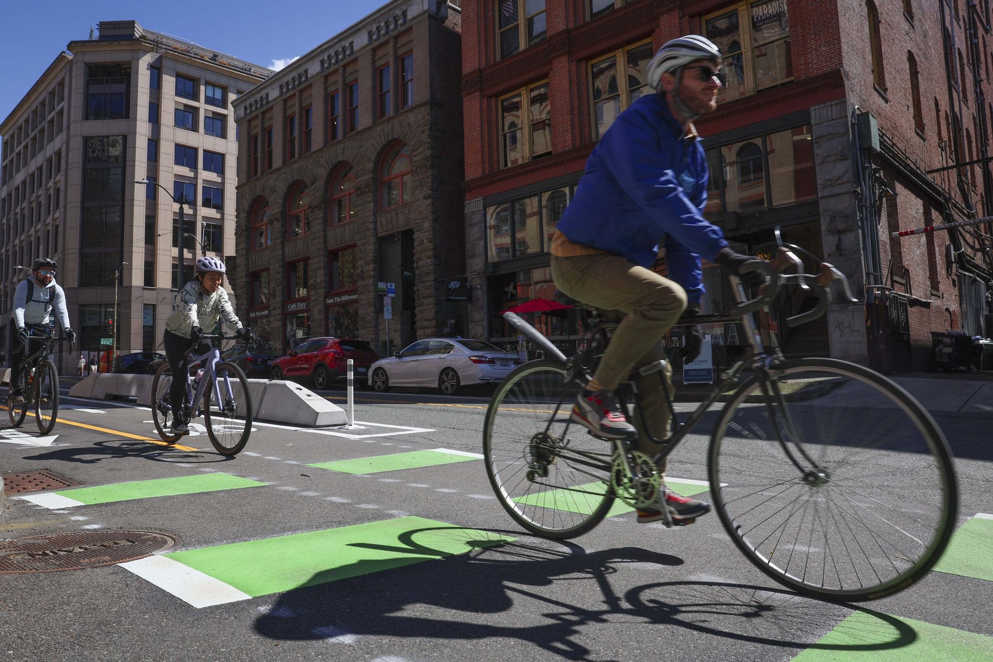
A new, seemingly modest bikeway opened on Yesler Way in the historic Pioneer Square neighborhood of Seattle. The project is part of the city's broader efforts to reduce car use, congestion and traffic crashes and to fight climate change by expanding bike infrastructure. Here the past meets the future: cyclists wait at a World War II–era traffic signal while modern electric scooters whiz by.
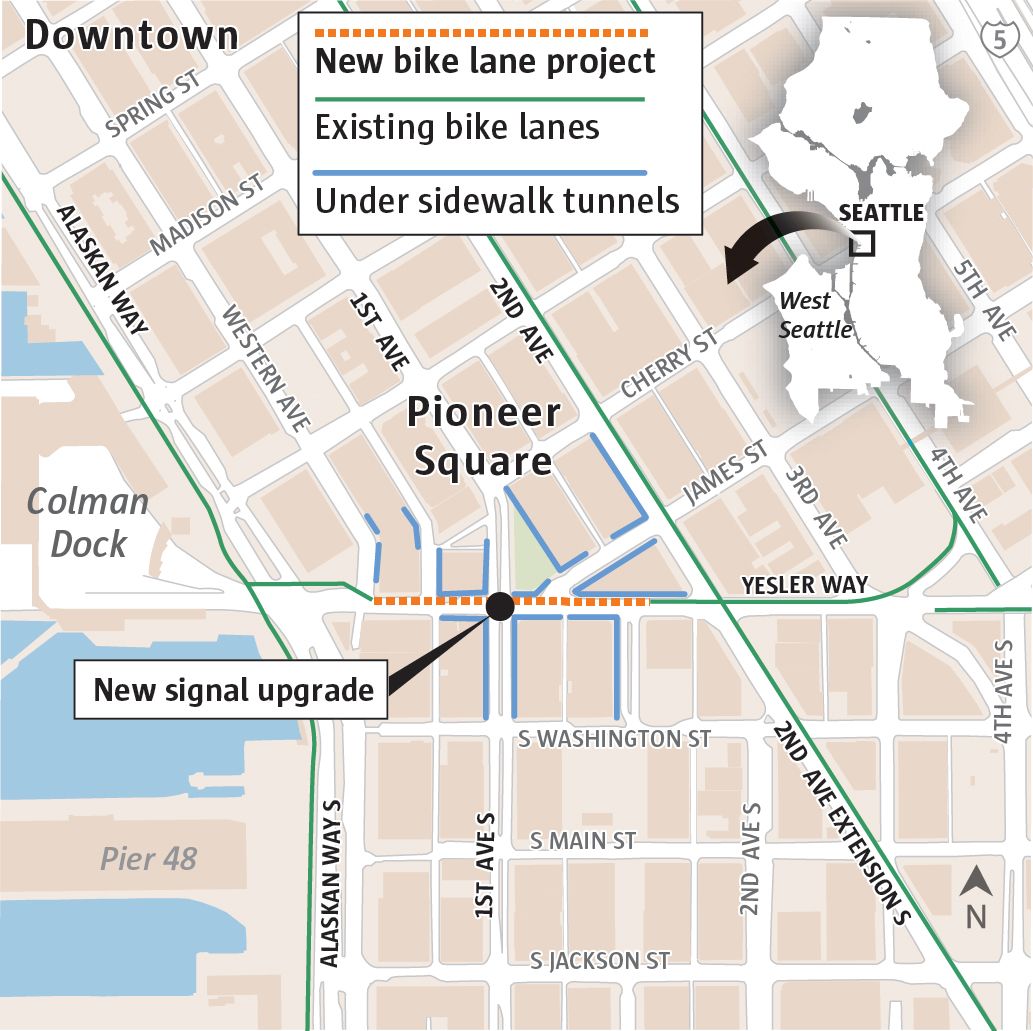
The new dedicated lane is only about 180 feet long, but its role in the transportation network is hard to overstate. It became the missing piece that connected the waterfront bike path to the main “spines” of the network — protected lanes on 2nd and 4th avenues downtown. Those protected bikeways are separated from car traffic by physical barriers, such as concrete blocks or raised curbs, which greatly increase cyclists’ safety and comfort compared with simple painted lanes. Now cyclists can safely and comfortably cross the entire downtown without encountering vehicle traffic.
The timing of the opening was tied to Seattle’s preparations for the FIFA World Cup matches at Lumen Field in summer 2024. Officials are aiming for 80% of the roughly 750,000 spectators to reach the stadium without a personal vehicle — by transit or bike. The new bike route to the stadium and ferry terminal is a key part of that plan.
Construction, however, faced serious challenges because of Pioneer Square’s unique historical infrastructure. Engineers had to integrate the new lane without disrupting old traffic signals that physically couldn’t support extra signal sections for bikes. A major complication was the extensive underground spaces beneath the streets — so-called “areaways.” These historic subterranean passages and tunnels, built in the late 19th and early 20th centuries to access basements, are a legacy of the Great Fire of 1889. After the disaster, streets in the flood-prone area were raised one or two levels. Today areaways are mostly considered an engineering legacy; some are used for storage or utilities, but many are abandoned. The walls that separate the modern roadway from these old underground sidewalks are load-bearing and literally “hold up” the street above, which complicates any roadwork.
Activists such as Gordon Peidelford of Seattle Streets Alliance say the bikeway removed a critically important “weak link” in the network. Seattle Streets Alliance — an influential advocacy group founded in 2011 to improve walking and biking infrastructure — advances such projects through campaigns and collaboration with city officials. Peidelford compares the transportation system to a highway whose exit runs into a wall: without this short connection on Yesler, the waterfront and downtown avenue bike infrastructure would be disjointed. Activists had pushed for this connection for years.
Still, problematic gaps remain in Seattle’s bike network that now become the new “weak links.” For example, an unsafe and unintuitive passage through the Chinatown-International District — where narrow streets, heavy traffic, frequent trucks and complex intersections with poor sightlines, such as S Jackson St and 5th Ave S, create risks for cyclists. There is also no convenient east-west bicycle route through South Lake Union. Other trouble spots in the city include parts of Aurora Avenue N, the Ballard Bridge area, some sections in West Seattle and streets in industrial zones like SODO, where bike infrastructure is fragmented. Even on the new Yesler lane, cars sometimes enter, confused by complex road markings.
Despite these difficulties, Peidelford and city officials view the progress positively. Just ten years ago there were no protected bike lanes in downtown Seattle, and now a full network is taking shape. Mayor Cathy Wilson has publicly supported these initiatives. The Yesler project, which cost $400,000, is just one of many steps to transform the transportation system.
Concluding the inspection,
Based on: Key Seattle bikeway connects more than its 600 feet suggest