This week the Cascades are expected to receive the biggest snowfall of the season, turning into a blizzard by Wednesday evening. The contrast in weather between the lowlands and the mountains is due to the orographic effect: moist air masses from the Pacific bring rain and wind to Seattle but cool as they rise over the Cascades, producing blizzard conditions at higher elevations. Winds will strengthen and visibility will drop sharply, prompting the National Weather Service to issue a blizzard warning. Meanwhile, residents of Seattle and the Puget Sound lowlands should prepare not for snow but for strong wind and rain.
Temperatures in Seattle itself will remain too warm for snow — daytime highs around +4 to +10°C (39–50°F). However, the probability of wind gusts exceeding 65 km/h (about 40 mph) on Wednesday is greater than 75%. The weather service warns of possible downed trees, snapped power lines and hazardous conditions on the water. Wind warnings are already in effect for nearly the entire western part of the state.
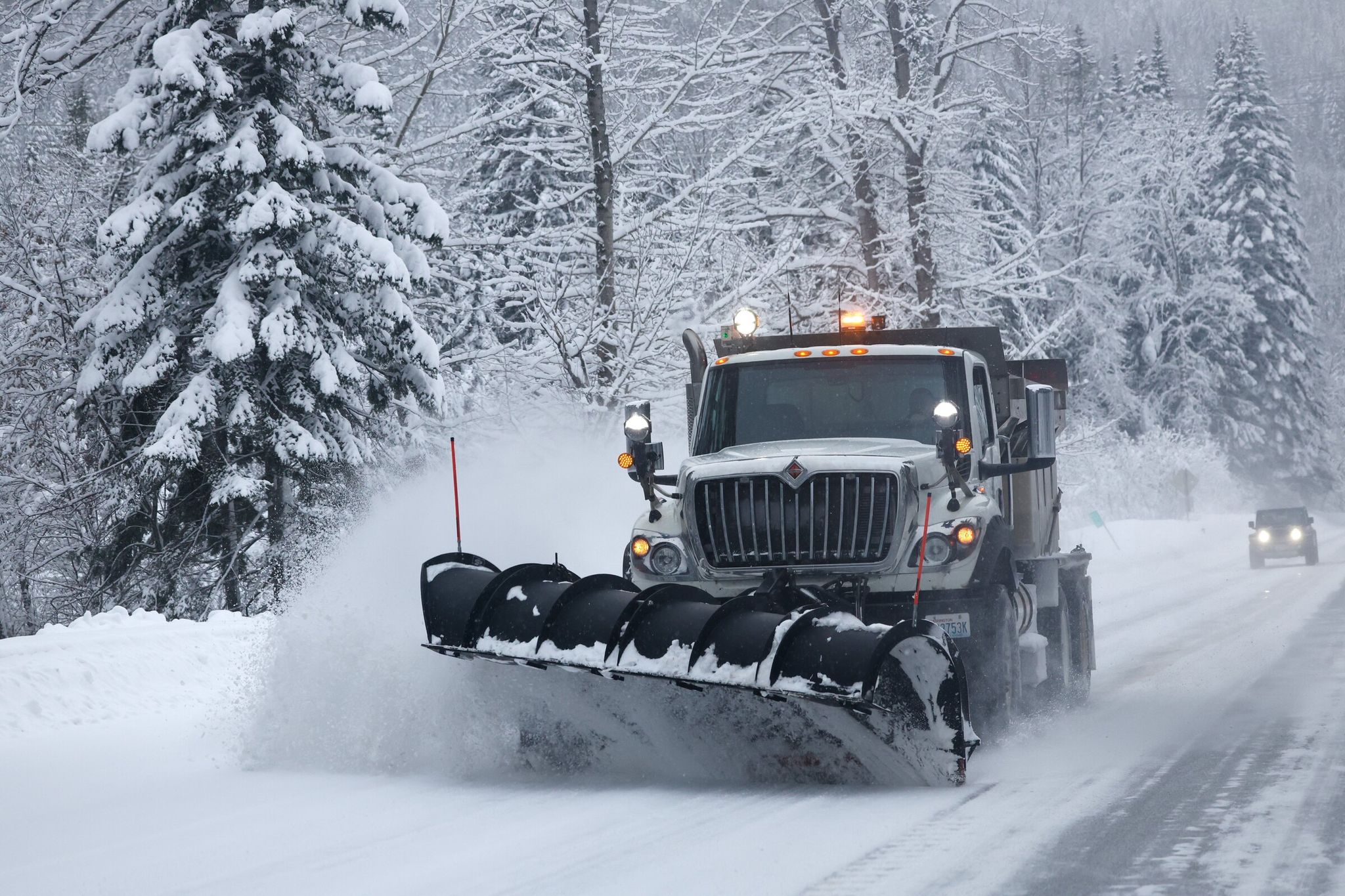
In the mountains, snow will continue into Thursday night, bringing 30–60 cm (12–24 in) of fresh accumulation. The combination of snowfall and winds up to 70 km/h (about 43 mph) will create extremely difficult travel conditions on mountain passes. This is especially critical for key transportation corridors such as Snoqualmie and Stevens passes, which connect western Washington with the eastern part of the state and support freight, tourism and daily commutes. Their closure due to snow could seriously disrupt economic activity and regional traffic. Despite this storm, the current snow season remains one of the weakest in the past decade: Snoqualmie and Stevens passes have seen only about 36% and 40% of normal seasonal snowfall, respectively, which also affects water supplies because snow serves as a natural reservoir for the region.
The outlook for the coming days remains wet. From Thursday an atmospheric river will begin impacting the region, ensuring continued rain in Seattle. In the mountains this could bring an additional up to 60 cm (about 24 in) of snow, continuing through the weekend, which would be favorable for ski resorts. Thus, although winter is finally arriving in the high country, the chances of seeing snow in Seattle itself this season have all but vanished, and city residents — who rarely deal with snow — will continue to depend on mountain resources, including water from snowmelt.
Based on: WA weather: High winds expected in Seattle, blizzard in Cascades