
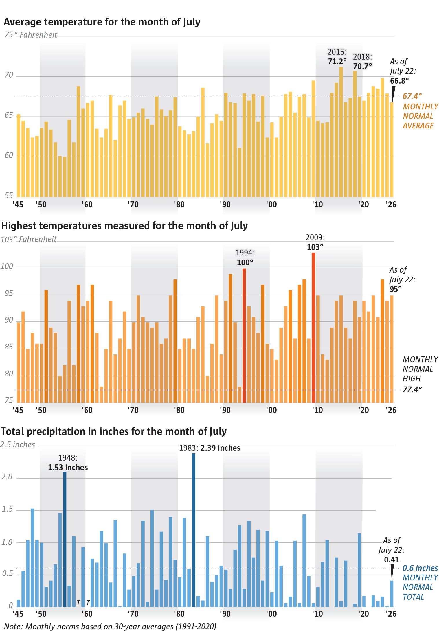
You made it through an exhausting heat spell. In Seattle, on Tuesday and Wednesday, temperatures climbed to a steamy and sticky 35 °C, while smoke from wildfires in central and eastern Washington hung in the sky. But early Thursday, a round of thunderstorms that rolled across Washington and Oregon put an end to this hot stretch—bringing rain and hundreds of lightning strikes.
According to National Weather Service meteorologist Jeff Michalaska, although some lightning was “dry,” many thunderstorms came with precipitation, which slightly lowers the risk of new fires. Thanks to a marine flow that helped drive the smoke away, temperatures dropped sharply to a comfortable 21–26 °C on Thursday—nearly matching the climate norm of 26 °C for this time of year.
On Friday, a modest return of warmth is expected—up to 29–30 °C—but by the weekend it will cool down again. On Saturday and Sunday, temperatures will hover around 24 °C, which is even below average.
For now, you can breathe easy with cooler, smoke-cleared air—enjoy this temporary break before the next round of heat, even if it’s short-lived.
Based on: Seattle weather: Significant cooldown follows heat wave